The Laurabada UltracubeTM project entailed the reprocessing of two open-file 3D datasets with a modern broadband de-ghosting and pre-stack depth migration sequence over what is highly sought-after acreage. The UltracubeTM is split into two cubes: The Eastern cube is near-shore, shallow water whilst the Western cube is deep-water in the Gulf of Papua.
There has been a significant data quality uplift from the reprocessing of the legacy data which has revealed exciting new potential in the Gulf of Papua.
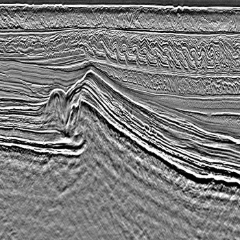
Source and receiver deghosting was applied in the reprocessing which significantly improves the low frequency content. For Laurabada East, this helps with the imaging below the fold belt as that is quite dispersive and attenuative with the seismic source. Similarly, on Laurabada West, there is multiple large carbonate bodies that are highly absorptive which is only penetrated by the low frequency signal.
The legacy processing only applied 2D SRME for the demultiple, whereas the reprocessing has used 3D GSMP/SRME from Western Geco. In the fold belt on Laurabada East this in particular helped with the complex diffracted multiples from the seabed that were contaminating the pre-Tertiary grabens. On Laurabada West there were complex peg leg multiples from the top carbonates which were modelled and subtracted effectively.
The legacy processing only used an isotropic PSTM workflow, whereas the reprocessing used an anisotropic TTI pre-stack depth migration. In Laurabada East, the PSDM workflow allowed for high resolution velocity modelling in the fold belt which improved the pre-Tertiary graben imaging and depthing. In Laurabada West, there was detailed carbonate velocity modelling which combined with the deghosting allowed for much improved resolution on the flanks and base of the carbonate pinnacles.
The Laurabada West UltracubeTM 3D Reprocessing Survey comprises of ~770km2 whilst the Laurabada East UltracubeTM 3D Reprocessing Survey covers ~1,020 km2.
Project parameters
| Project Size | ~1,020 sqkm |
|---|---|
| Key Processing Parameters | Source and receiver broadband deghosting 3D SRME 5 iterations of anisotropic tomography for velocity model building |
| Deliverables | Kirchhoff Pre-Stack Depth Migration Kirchhoff PSDM Full stack and 4 angle stacks Kirchhoff PSDM final CDP gathers Velocity and anisotropy products |
Featured Projects
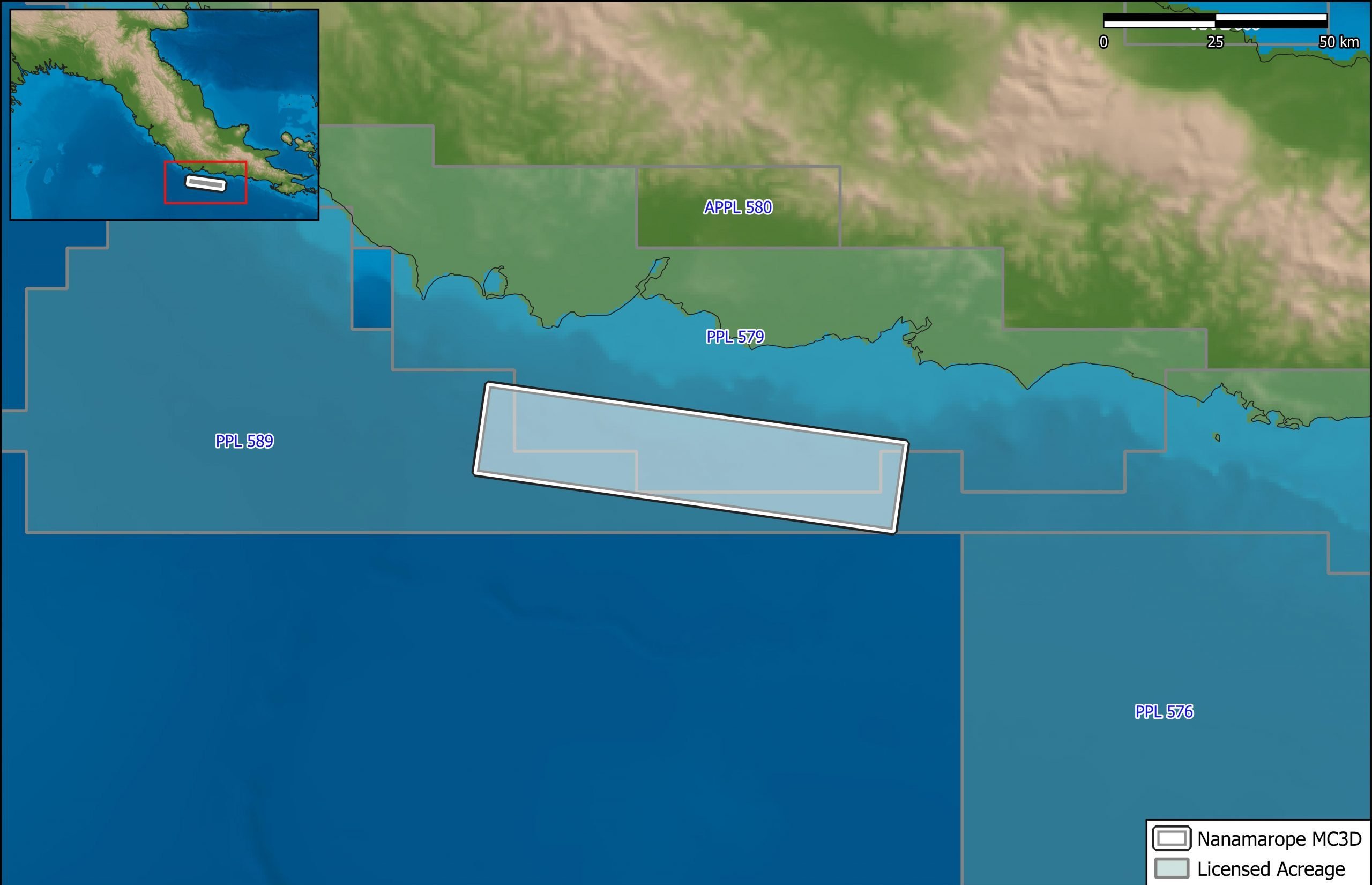
Nanamarope 3D Seismic Survey
Searcher in cooperation with the Department of Petroleum & Energy and Larus Energy is pleased to announce that...
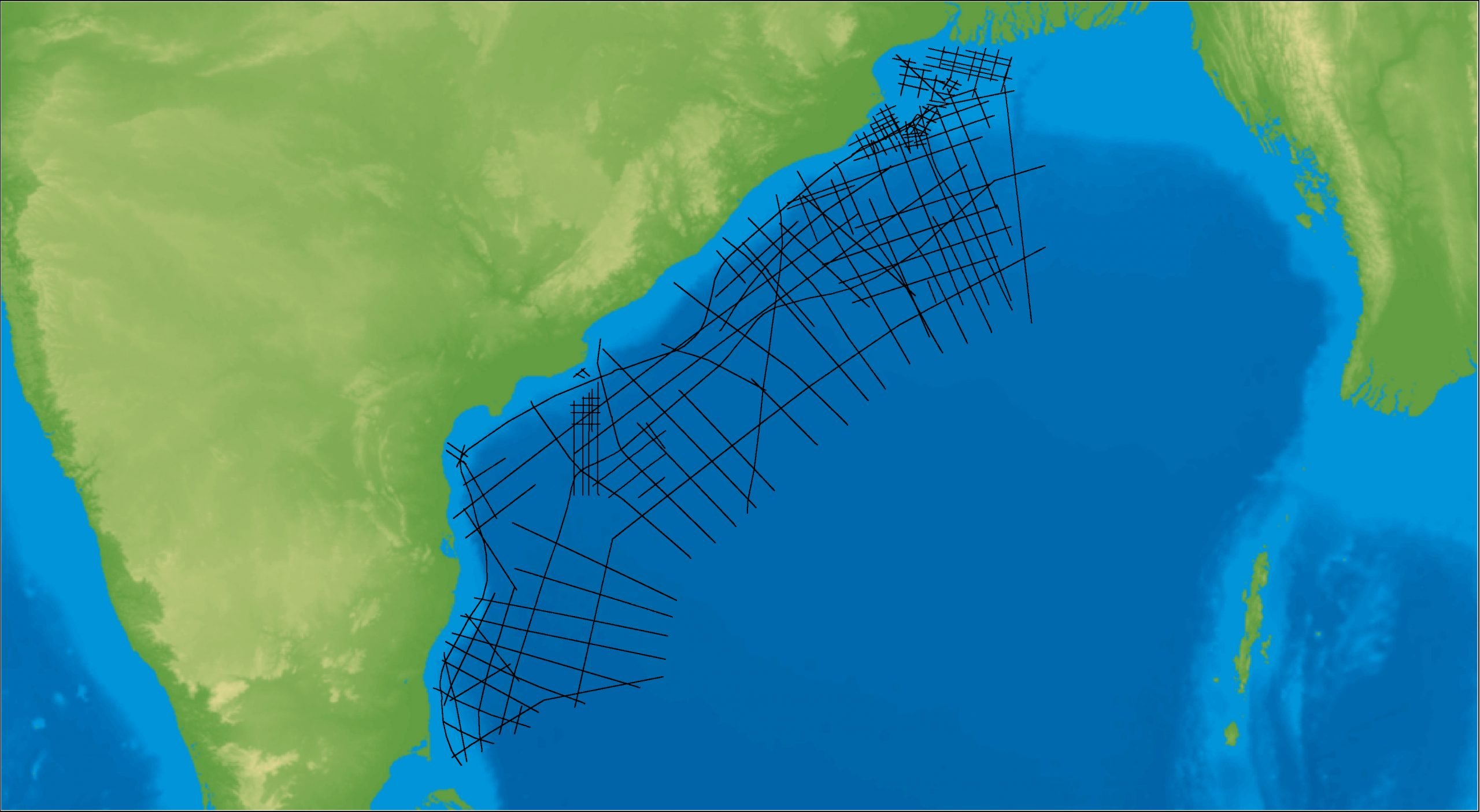
East Coast India Rectified 2D
East Coast India has proven its potential with exploration successes from the Ganges Delta to Krishna-Godavari Basin, and...