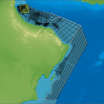
Searchre, in cooperation with the Sudan Ministry of Energy and Petroleum, has released the rectified Sudan 2D Seismic Survey.
The Sudan 2D Seismic Survey consists of 18,000 km of data to which Searcher has applied its proprietary post-stack reprocessing method, that rectifies navigation, metadata, amplitude, phase and time.
The 2D seismic reveals a stunning array of super-giant syn-rift plays in the pre-salt, capped by halite walls and canopies lying between mini-basins which offer a proven post-salt fairway.
The Sudanese Red Sea is one of the world’s newest, and as a consequence most exciting, underexplored passive margins. Lying between Egyptian and Eritrean waters on the Western side of the Red Sea, the 57,000 sq. km of margin offshore Sudan is barely explored. On the five open blocks in Sudan’s Red Sea area, only 14 wells have been drilled over the last 60 years since exploration began in the 1950’s, yet these wells have proven a working hydrocarbon system.
The Sudan 2D Seismic Survey allows industry to map multiple prospects in the underexplored Red Sea. Searcher is preparing for a 2023 3D seismic campaign which is the next piece to the offshore Sudan oil puzzle. Modern 3D seismic imaging is essential to correctly image the salt and understand the hydrocarbon system development in the area.
This will be the crucial step on Sudan’s Red Sea journey to offshore exploration greatness in preparation for the drilling of vast pre-salt and mini-basin plays in this soon-to-be super basin.
The Sudan 2D Rectified Seismic Dataset is now available for industry licensing on Searcher’s sAIsmic on-demand platform.
Project parameters
| Project Size | 17,941 km |
|---|
Featured Projects
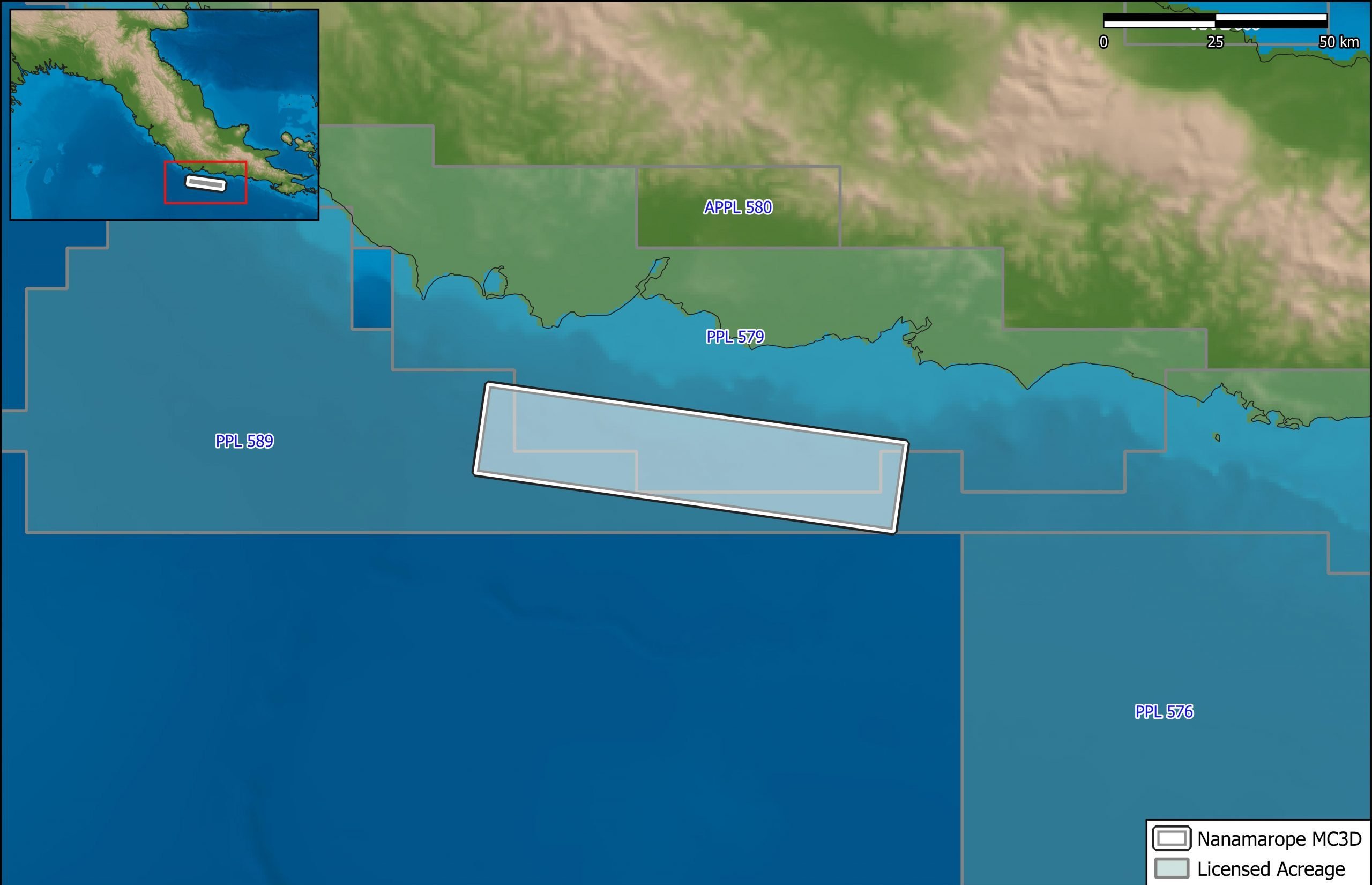
Nanamarope 3D Seismic Survey
Searcher in cooperation with the Department of Petroleum & Energy and Larus Energy is pleased to announce that...
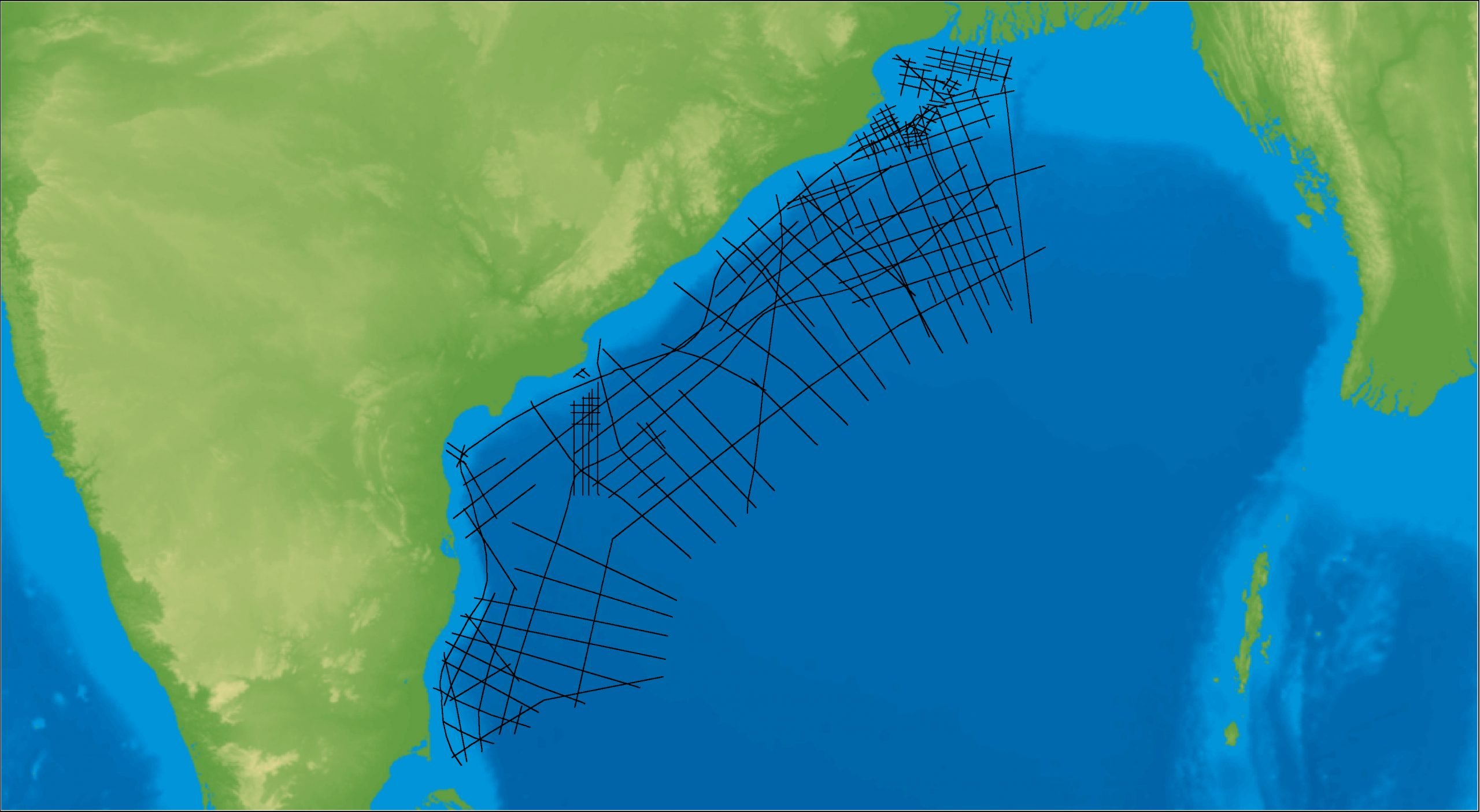
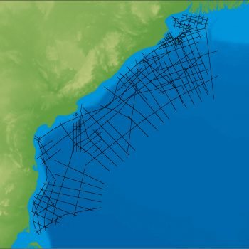
East Coast India Rectified 2D
East Coast India has proven its potential with exploration successes from the Ganges Delta to Krishna-Godavari Basin, and...
Related resources
Sudan’s Red Sea oil