The Pangea 2D Reprocessing comprises 4,880 kilometres of reprocessed 2D seismic data over the Eastern Canning Basin. Pangea 2D Reprocessing is a revealing data set that gives a deep understanding of the tectonic evolution of the eastern Canning Basin. The data also provides insights that previous studies and exploration may have overlooked, to unlock the resource potential for both mineral and petroleum systems.
Using modern processing algorithms combined with accurate navigation and statics controls, the resulting imaging quality of the Pangea data set far exceeds any previous vintages of data.
Integrating these seismic data with other regional and detailed geophysical and geological information, geoscientists can begin to unravel the complex structural and stratigraphic framework of the province with a higher level of confidence and accuracy.
“We are very excited to be expanded our onshore presence in the onshore Canning Basin that both the mining and energy industry will be able to utilise in their exploration activities. Seismic data is widely used in energy exploration and is being increasingly used in mineral exploration for regional project generation and targeting of mineral deposits,” said Alan Hopping, General Manager at Searcher.
The Pangea 2D Reprocessing project is available now.
For more information, contact us at sales@searcherseismic.com
Project parameters
| Project Size | 4,880 km |
|---|
Featured Projects
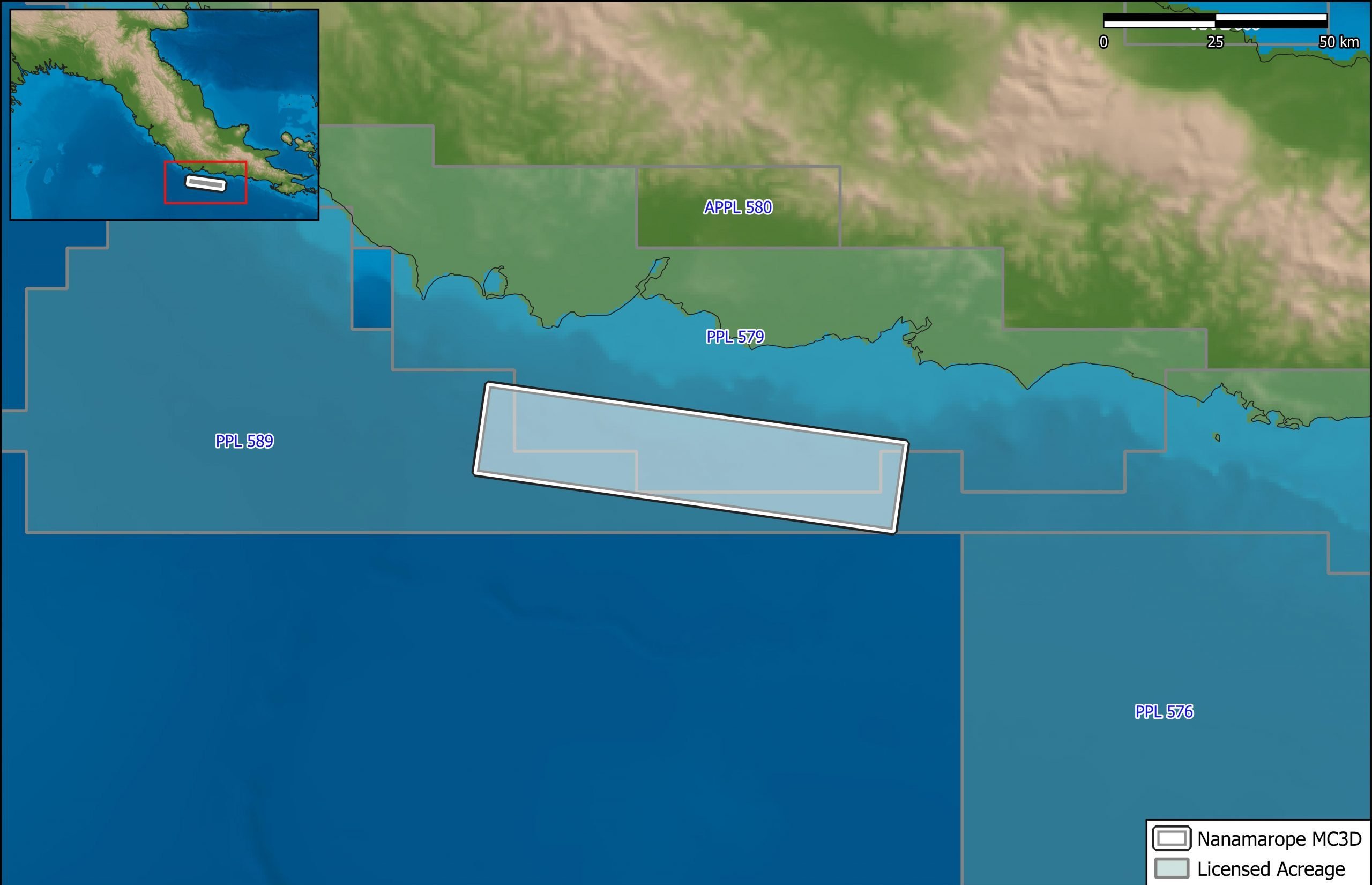
Nanamarope 3D Seismic Survey
Searcher in cooperation with the Department of Petroleum & Energy and Larus Energy is pleased to announce that...
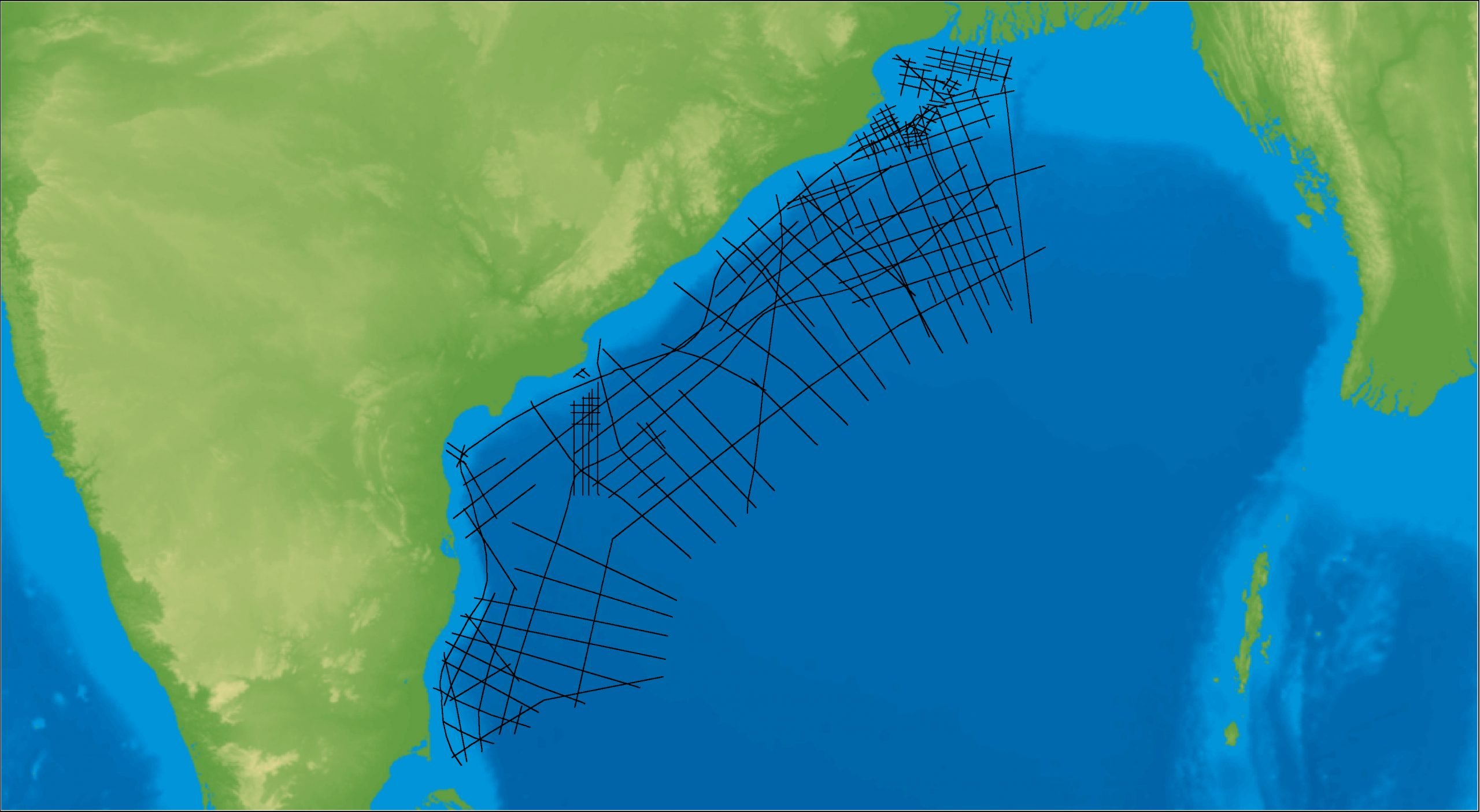
East Coast India Rectified 2D
East Coast India has proven its potential with exploration successes from the Ganges Delta to Krishna-Godavari Basin, and...