Havspurv High Resolution 2D Seismic Survey is 10,011 km of acquired high resolution data over the Barents Sea.
The Havspurv High Resolution 2D Seismic Survey (NPD Seismic Survey SS1101) provides oil companies with the first ever regional survey in the Barents Sea, focusing on the main structural elements with correct imaging of the upper sedimentary units and the fault patterns near the sea floor.
Havspurv 2D Seismic Survey was designed to utilise a high frequency source signature in order to further enhance the high frequency signal recoverable in the data. The survey provides high resolution imaging of the shallow units and fault patterns to allow better understanding of the distribution of hydrocarbons and fault systems. Recent discoveries in the Barents Sea have proven the need for this high spatial resolution to delineate faulting and structural trapping within the first 1-2 seconds of data acquired.
The data processing is tailored to maintain the high frequency content with the latest demultiple algorithms being employed. A full suite of additional products have been generated during the PSTM sequence and allows further work such as AVO studies. The additional products available and the high sample rate of acquisition is also of benefit for further inversion studies.

Project parameters
| Project Size | ~10,000 km |
|---|---|
| Acquisition Details | RV Professor Kurentsov 1,030 cubic inches airgun array 24 bits digital streamer |
| Acquisition Parameters | Sample Rate: 1 ms Record Length: 6 sec Streamer Length: 5 km |
| Key Processing Parameters | High Resolution focus to shallow section |
| Deliverables | Final Full Angle PSTM Volume (AGC) SEGY True Amplitude Angle Stacks (Near, Mid, Far, Full) SEGY AVO Products (Intercept, Gradient, IxG) SEGY Final NMO Corrected PSTM Gathers SEGY Pre-Migration Radon Gathers SEGY Final Stacking Velocity ASCII Final Migration Velocity ASCII Navigation Data P190 Acquisition Report PDF Processing Report PDF |
Project partners
MAGE
Featured Projects
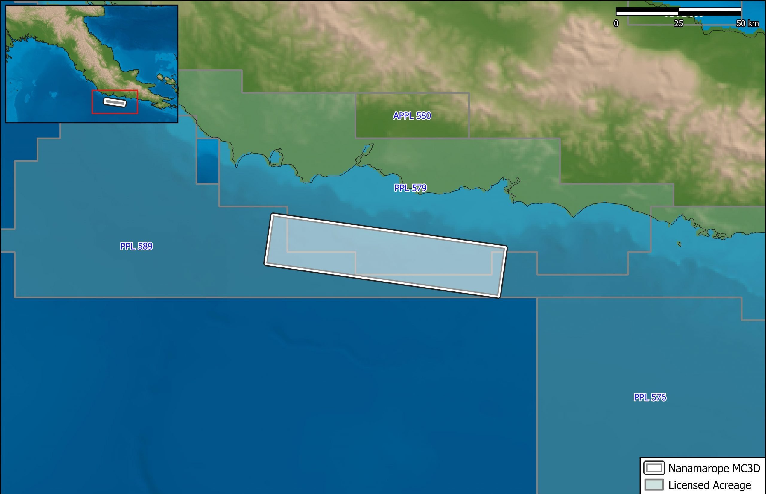
Nanamarope 3D Seismic Survey
Searcher in cooperation with the Department of Petroleum & Energy and Larus Energy is pleased to announce that...
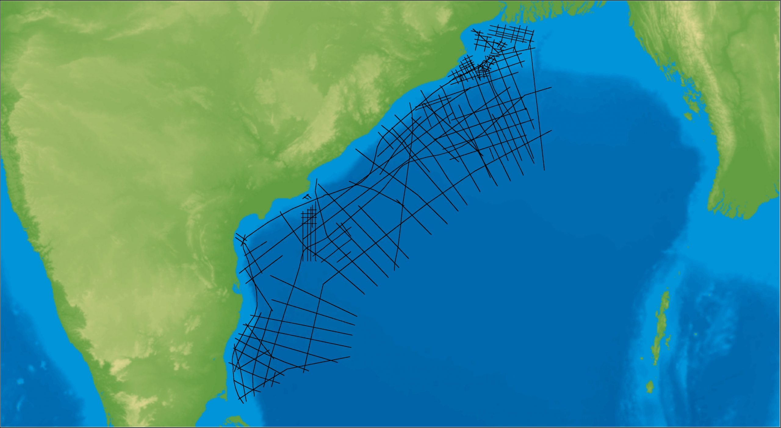
East Coast India Rectified 2D
East Coast India has proven its potential with exploration successes from the Ganges Delta to Krishna-Godavari Basin, and...