The Northern Basins are true frontier regions offering the potential for working petroleum systems.
The Bougainville Basin, Cape Vogel and New Ireland Basin are the three basins offshore NE Papua New Guinea. This frontier region remains largely unexplored with new regional 2D revealing new insights into the deep structure, stratigraphy and evolution of this frontier region.
Comprising ~3,600 km, the Solomon Sea Broadband 2D Seismic Survey spans the underexplored Cape Vogel and Bougainville Basins as well as the unexplored New Ireland Basin. Gravity and magnetic data has also been acquired and processed which is now available with seismic data.
The survey follows the recent spark in activity offshore the Gulf of Papua, where modern broadband processing techniques unveiled exciting new potential in the area.
Given the complex tectonic history of the basins the Solomon Sea 2D covers and industry’s continued interest in the region, Searcher is excited to uncover the potential of northern PNG.
Project parameters
| Project Size | ~3,600 KM |
|---|---|
| Acquisition Details | Vessel: BGP Explorer Streamer: Sercel Sentinel Solid Streamer Source: 1 x 4300 in3 Airgun Array Gravity and magnetic data acquired and processed |
| Acquisition Parameters | Sample Rate: 2 ms SP Int: 37.5 m Record Length: 14+ sec Tow Depth: 15 m Streamer Length: 10+ km |
| Deliverables | Final PSDM Full Angle Stack (in time and depth) Final True Amplitude PSDM Angle Stacks (Full, Near, Mid, Far, & Ultrafar) (time and depth) Final Imaging Velocity Field (in time and depth) Navigation Data Processing Report Acquisition Report Gravity and magnetic data |
Project partners
BGP
Featured Projects
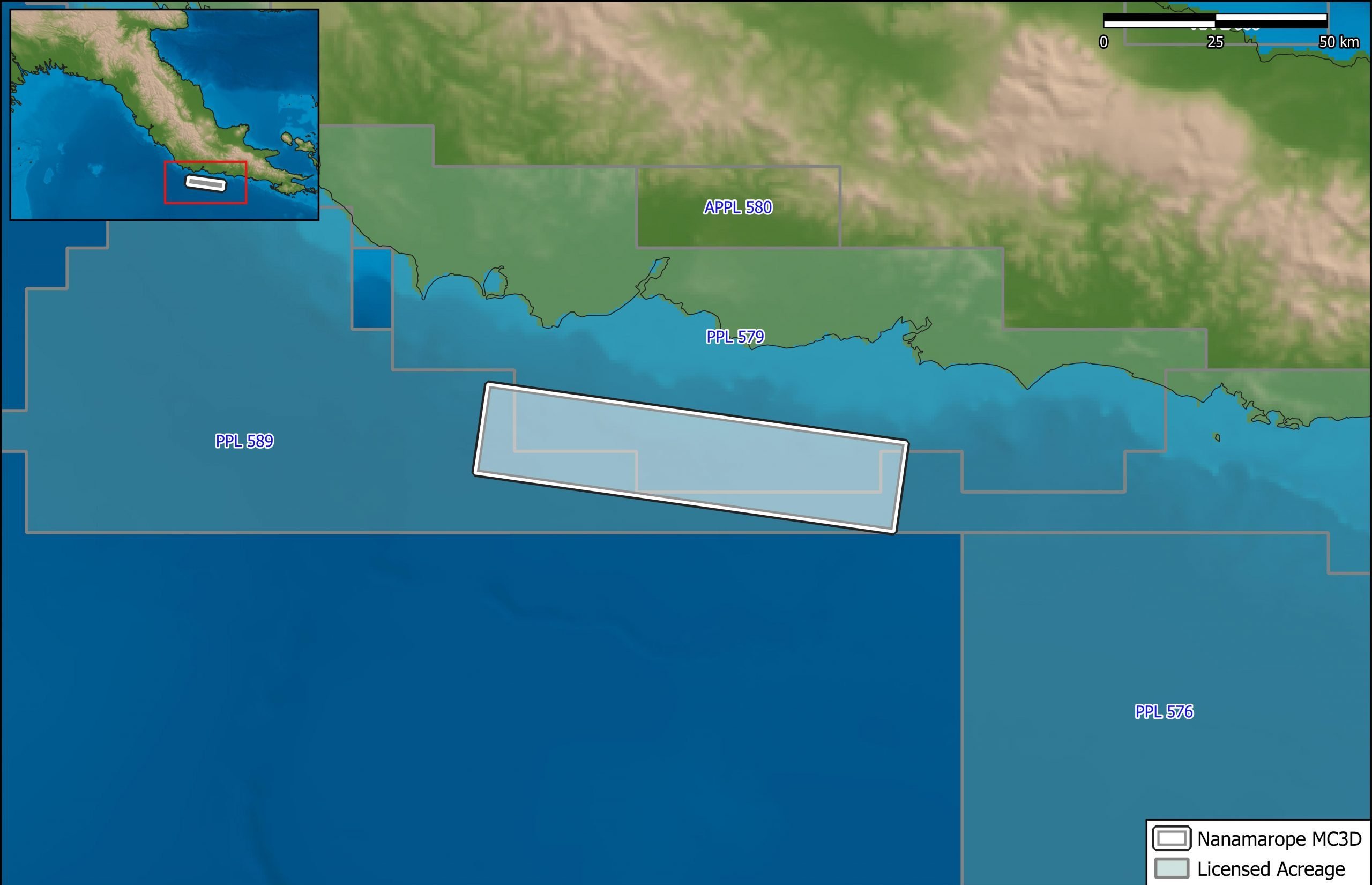
Nanamarope 3D Seismic Survey
Searcher in cooperation with the Department of Petroleum & Energy and Larus Energy is pleased to announce that...
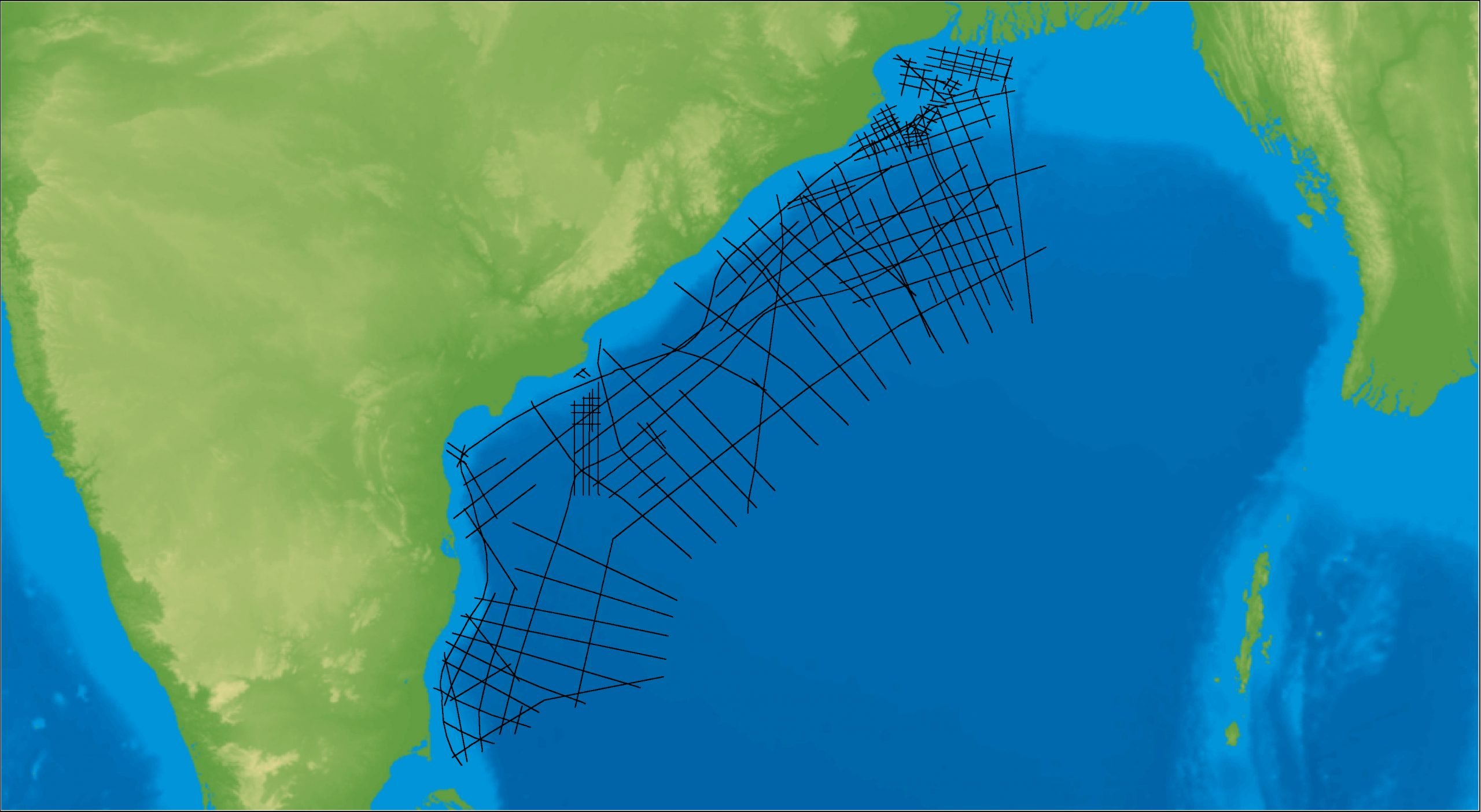
East Coast India Rectified 2D
East Coast India has proven its potential with exploration successes from the Ganges Delta to Krishna-Godavari Basin, and...
Related resources
Papua New Guinea’s Northern Basins: A Fresh Look at the Bougainville Basins
Amiribesheli, S. and Weller, A., 2018, Presented at: PESGB SEAPEX Asia Pacific E&P Conference, London, England