Numbat Non-Exclusive 3D Seismic Survey consists of newly acquired seismic data comprising of ~140 sq km of 3D.
The Numbat Survey is located on the southern flank of the Barrow Sub-basin. There are numerous oil and gas accumulations in the area and the survey is designed to provide broadband, high resolution coverage to define Early Cretaceous and Triassic prospects and leads.
For more information on the Numbat Non-Exclusive 3D Seismic Survey, contact us directly.
Project parameters
| Project Size | ~140 sq km |
|---|---|
| Acquisition Details | Vessel: BGP Explorer Streamer: Sercel Sentinel Solid Streamer Source: 1440 in3 |
| Acquisition Parameters | Sample Rate: 2 mSec SP Int: 12.5m Record Length: 5 Sec Streamer Length: 4 x 4000m @ 75 m Separation |
| Deliverables | Final Full Stack Volume (AGC) (in time and depth) True Amplitude Angle Volumes (Full,Near, Mid, Far,Ultra-Far) (in time and depth) Pre-stack final PSDM CMP’s after Residual RMO Final Migration Velocities Anisotropy Volumes (Epsilon and Delta) Processing Report Bin Centre Map |
Project partners
BGP
Featured Projects
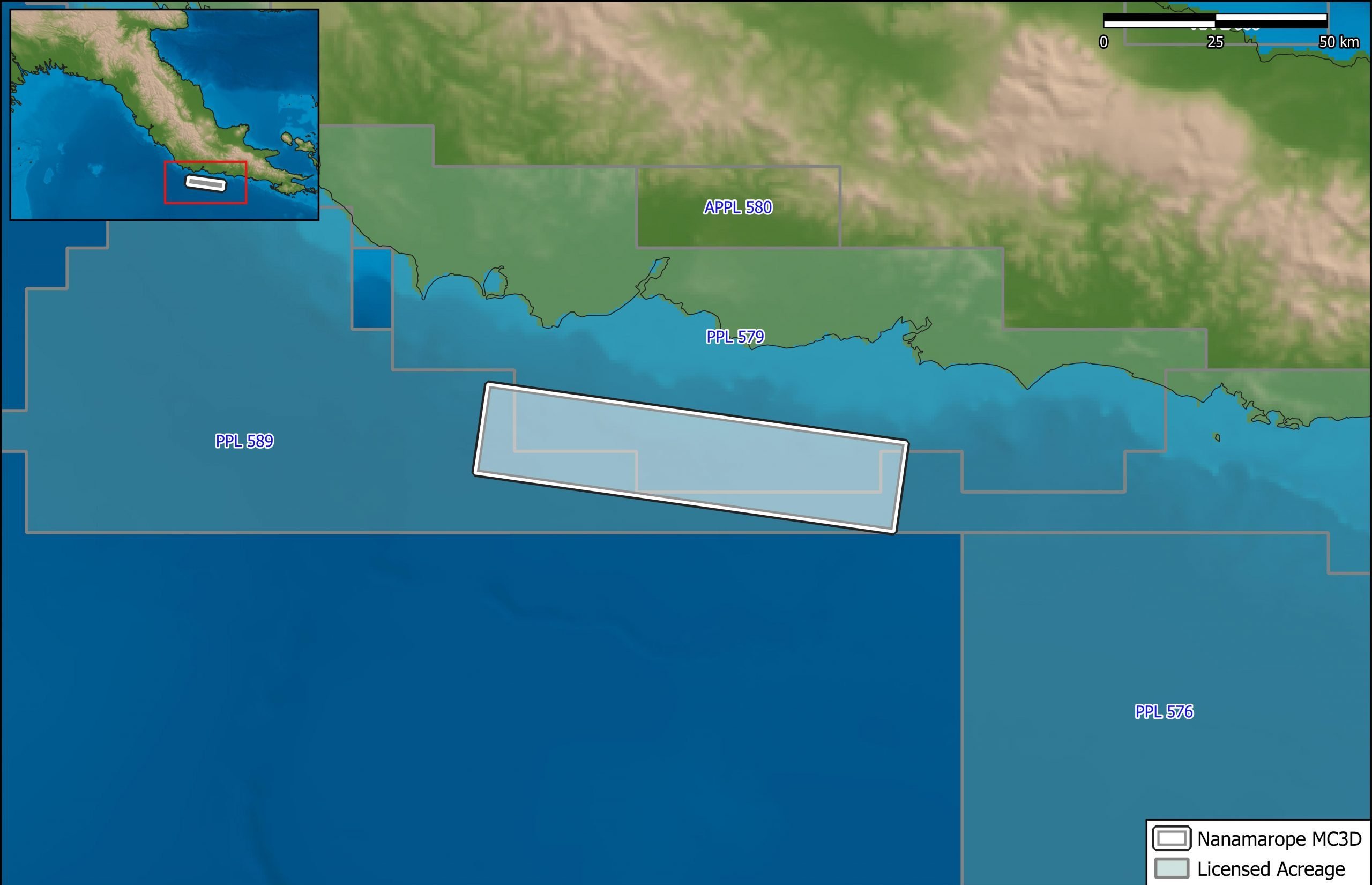
Nanamarope 3D Seismic Survey
Searcher in cooperation with the Department of Petroleum & Energy and Larus Energy is pleased to announce that...
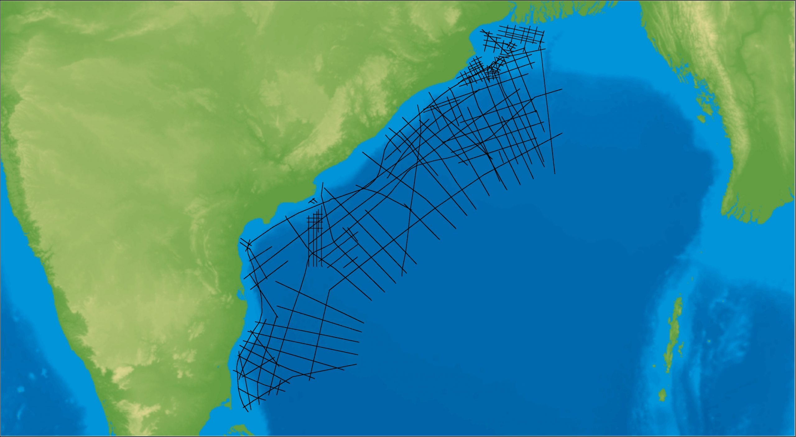
East Coast India Rectified 2D
East Coast India has proven its potential with exploration successes from the Ganges Delta to Krishna-Godavari Basin, and...