Mexico

Explore Mexico

The Gulf of Mexico (GOM) is one of most prominent offshore exploration regions and has become known for its salt associated discoveries and mega oil finds

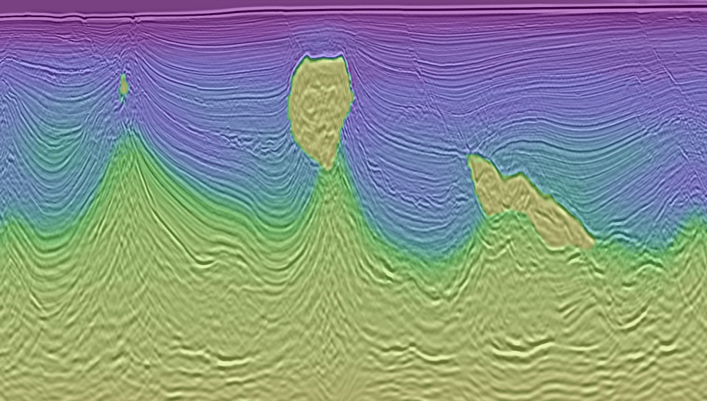
The GOM has a long and complex depositional history and is extensive in size, attracting explorers from around the world. Abundant salt pillows and diapirs populate the subsurface of the GOM resulting in a need for thorough and modern processing sequences to obtain accurate seismic imaging.

The GOM contains multiple, thick, source rock intervals resulting in multiple petroleum systems throughout the region. The area continues to remain one of the most successful exploration provinces despite maturity as the drive for understanding the complex area and the hunt for the large variety of undiscovered play types continues.

South Campeche 3D Reprocessing

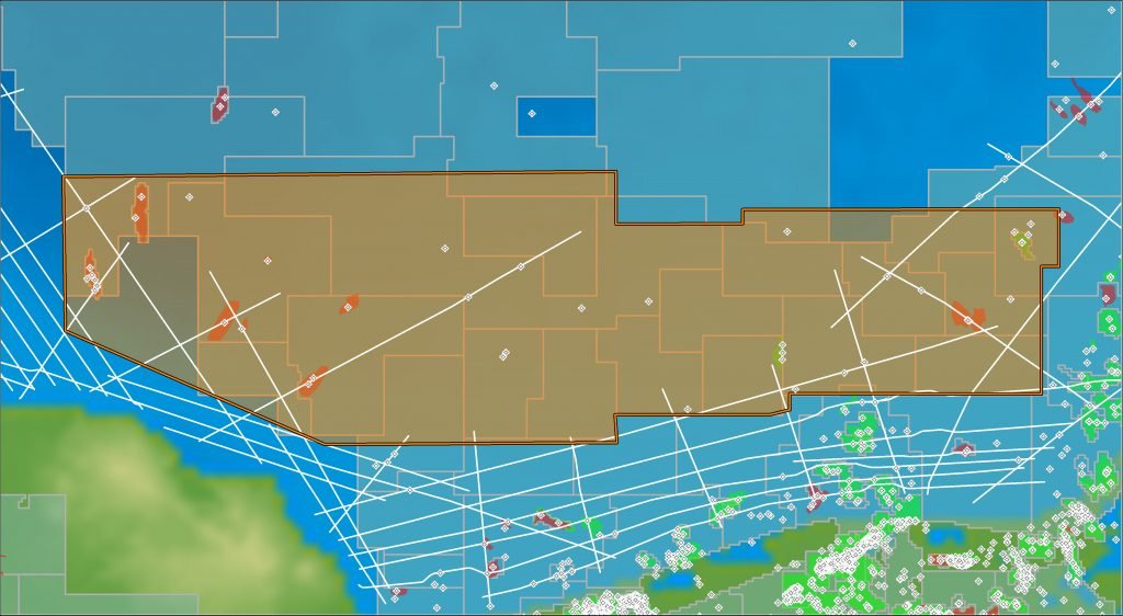
The South Campeche Ultracube™ 3D Reprocessing project comprises approximately 15,900 sq km and is located in one of Mexico’s most prominent offshore exploration areas, with several proven oil and gas discoveries.

The project is a merge of three existing surveys; the Holok Alvardo 3D (2003), the Cequi 3D (2010) and the Boloi Norte-Balche-Xulum 3D (2003).

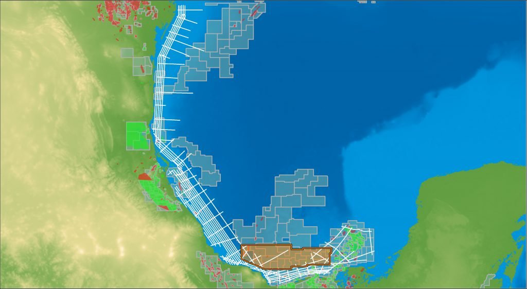
The new 3D Ultracube extends over 260 km in the southern part of the Campeche Bay area and provides new depth imaging of the Southern Campeche – Sigsbee Basin and also parts of the offshore Comalcalco Basin. The southern part of Mexican Ridges in the Veracruz Basin are also covered by the new South Campeche Ultracube.

75% of the South Campeche Ultracube is located in waters less than 1,000 metres in depth; with the shallowest water depth being approximately 30 metres.

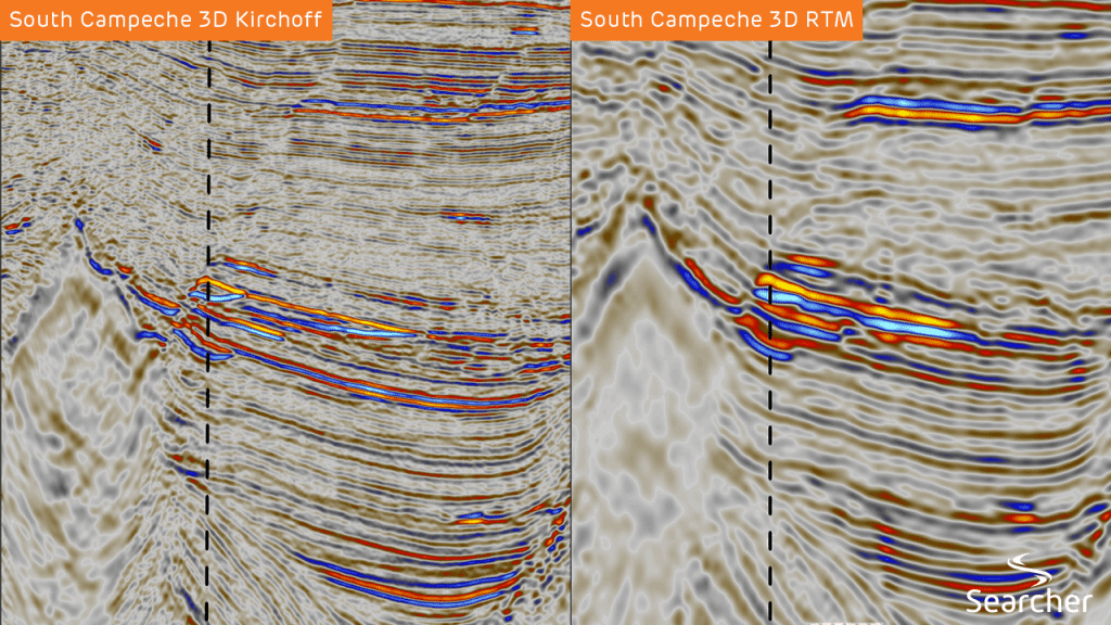
The project incorporates a very thorough pre-stack imaging and post-stack processing sequence staged in two parts. Firstly, the pre-processing produces high S/N ratio, broadband data and secondly, imaging using TTI Kirchhoff and RTM technologies to properly image the subsurface, often with extensive salt pillows and diapirs.

Buscador Near-Shore 2D

The Buscador Near-shore 2D survey comprises approximately 11,100 km of high quality, long-offset newly acquired 2D data, designed to tie key exploration wells and establish a regional tectonic framework from which to conduct basin modelling and seismic stratigraphic analysis of the entire prospective near-shore Mexican offshore area.

The survey covers both proven mature and semi-mature prospective regions and also enters into shallow-water areas with no or limited drilling activity to date.

Careful attention to exact well ties provide a reliable cost-efficient dataset enabling explorers to create regional interpretations.

Plan, track and review your surveys with Seisintel

Seisintel is a web portal product which provides live and historic survey information and vessel usage information for the marine survey industry.

Seisintel derives this information from Automated Identification System (AIS) data loads and manual database population of survey and client details.

Plan, track and review the acquisition of your own seismic surveys along with all marine activity, offshore Australia. Seisintel provides a wealth of knowledge on all aspects of the global marine fleet.

Explore further with Discover Geoscience

Searcher G&G team, Discover Geoscience, are petroleum subsurface consultancy which provides expert subsurface assistance to the global oil and gas industry through its G&G team of highly experienced geoscientists.

As well as exclusively producing Searcher’s Mexico Basin Analysis Report, Discover Geoscience have vast experience in the region and have completed comprehensive interpretations of the entire Searcher data library.

Discover Geoscience are able to assist in any exploration needs with a tailored service to evaluating client acreage and new venture activities. Our highly skilled team offer a full-cycle project evaluation, from data collection, well planning to infill drilling programs.