Timor-Leste Second Licensing Round 2021

Timor-Leste 2nd Licensing Round is Open

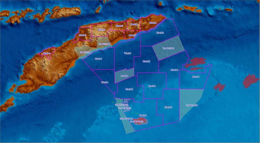
On 3 October 2019, the Prime Minister of the Democratic Republic of Timor-Leste, Taur Matan Ruak, announced its Second Licensing Round. Timor-Leste’s Petroleum Authority, Autoridade Nacional Do Petroleo E Minerals (ANPM), released a total of 18 new blocks for public tender of the Productions Sharing Contracts. The 18 new blocks on offer consist of 7 new blocks in the Onshore and remaining 11 new blocks in the Offshore Area.

Timor-Leste’s petroleum authorities have extended the bid submission date for the country’s current exploration licensing round by five months. Bid submissions are now due on 4 March 2022, instead of 1 October 2021, which itself was a 12-month extension from the original due date.

Begin your research with Searcher's GeoClerk

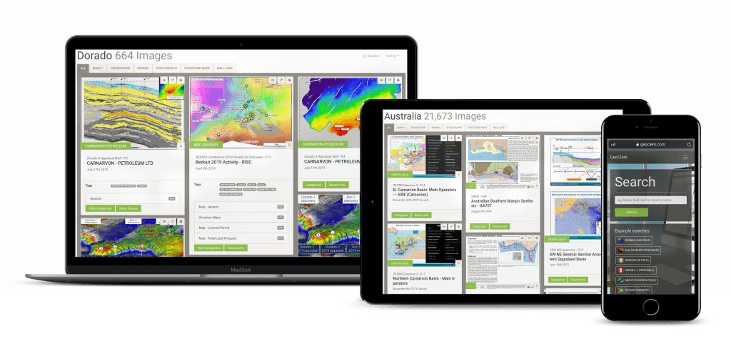
GeoClerk is a web-based platform that utilises machine learning to source industry related imagery and link back to its source documents.

GeoClerk unlocks a wealth of valuable, industry relevant information that was previously hidden within and around images in legacy geoscience publications. GeoClerk classifies and extracts imagery and pertinent data from unstructured documents, which is then collated in searchable and filterable geo-imagery libraries for convenient access.

Timor-Leste Data & Study Package

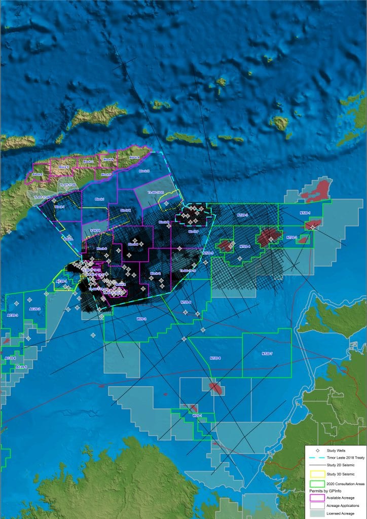
In collaboration with Timor-Leste’s Petroleum Authority, Autoridade Nacional Do Petroleo E Minerals (ANPM), Searcher is offering the industry an Offshore Timor-Leste Data and Study Package.

Searcher, together with Discover Geoscience (Searcher’s G&G team), are offering the industry rapid access to a comprehensive open-file seismic package which will significantly expedite our clients ability to access a collection of organized seismic and well data to assist in the evaluation of the country’s second petroleum licensing round. To further complement and leverage on the value of the subsurface database, a technical prospectivity study is available for the entire offshore bidding area, including regional geology, prospectivity ranking and potential play identification.

Timor-Leste Seismic & Well Dataset

Delivered on the work-station software of your choice, the Offshore Timor-Leste Data Package provides a comprehensive and fit-for-purpose catalogue of the country’s open-file data which includes ~102,700 kms of 2D and 22,500 km2 of 3D open-file seismic, all rectified. 109 open-file wells complement the extensive subsurface database with 85+ of those containing digital profile information. The combination of both interpreted seismic and wells provide a regionally consistent framework to evaluate the license blocks on offer.

Offshore Prospectivity Study

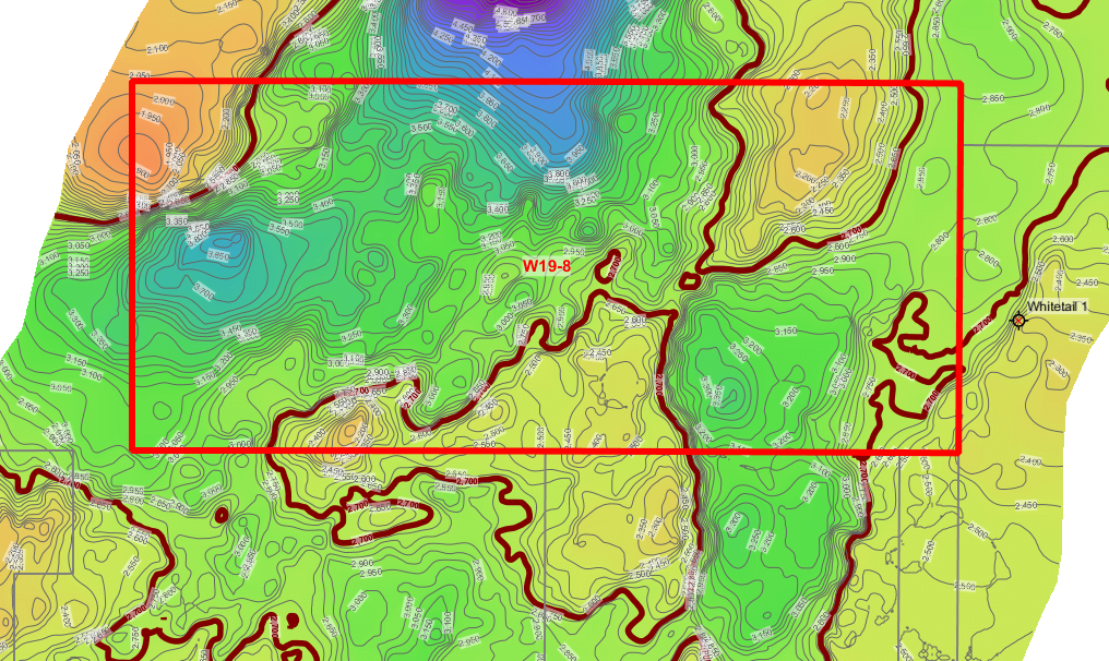
The Offshore Prospectivity Study provides a comprehensive regional play-based evaluation of the offshore license block areas and is based upon the interpretation contained within the Seismic Package. The study utilizes a multidisciplinary approach to evaluate all play levels of the region from the Permian to Cretaceous, with an extensive review of the under-explored Triassic potential play types. All products are delivered in GIS format.

Searcher’s Timor-Lester Data and Study Package provides a compelling opportunity for companies to gain fast access to a data-rich catalogue of highly organized regionally consistent subsurface data. The data package has been interpreted and evaluated by respected geoscientists in a completely independent third-party evaluation, enabling clients to quickly evaluate the blocks available in Timor-Leste’s second Licensing Round.

Plan, track and review your surveys with Seisintel

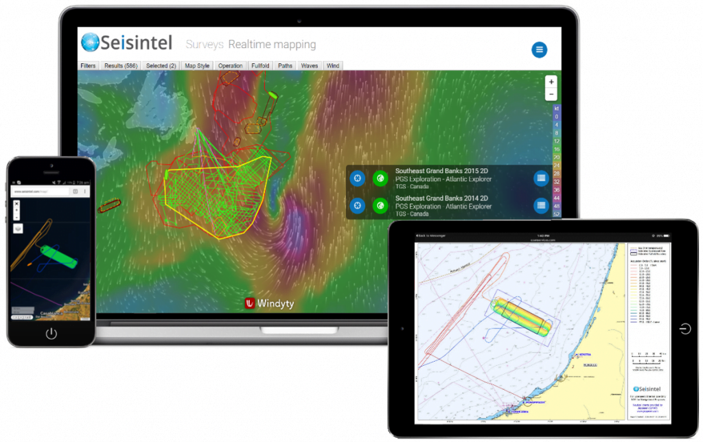
Seisintel is a web portal product which provides live and historic survey information and vessel usage information for the marine survey industry.

Seisintel derives this information from Automated Identification System (AIS) data loads and manual database population of survey and client details.

Plan, track and review the acquisition of your own seismic surveys along with all marine activity, offshore Australia. Seisintel provides a wealth of knowledge on all aspects of the global marine fleet.

Evaluate your AOI with Searcher G&G team - Discover Geoscience

Searcher G&G – Discover Geoscience are petroleum subsurface consultancy which provides expert subsurface assistance to the global oil and gas industry through its G&G team of highly experienced geoscientists.

Discover Geoscience are able to assist in any exploration needs with a tailored service to evaluating clients acreage and new venture activities.

Discover Geoscience  has undertaken multiple gazettal block studies for various global bidding rounds. The studies were tailored to the specific needs of each client and varied from basin wide to targeted block studies. Concept and lead inventories were compiled, along with play fairway maps, palaeogeographic maps, seismic facies analysis, interpretation of key horizons, volumetrics, quantitative interpretation studies, well post-mortem analysis, and well log conditioning.